Enhancing Virtual Singapore with BIM Data
This article was originally published in Geomatics World.
The 'Virtual Singapore' platform will include a software and data standards component to automate the enhancement of information from source BIM data models.
Drawing on leading science and design principles, Singapore combines characteristics from both the natural and man-made environments in a way that creates a sense of harmony and balance, also giving the city its unique feel and identity. This is best observed from any number of skyline terrace bars in downtown Singapore, but especially during the sunset hours – the transition between day and night as light reflects across the Marina Bay, and all the shiny edges and surfaces, showcase a real ‘smart city’ in motion. It is clear to see that Singapore’s status, as an often-cited global exemplar ‘garden city’, is well deserved.
The concept of smart cities is certainly not new. However, what is new (or at least different from before), is the pace at which the concept of smart cities seems to be changing. The main factor limiting the pace of change is access and availability of knowledge and understanding about the outcomes that can be realised when data is used effectively. An understanding of what can be achieved when methods to share data are embraced and fully adopted is also missing.
Virtual Singapore is a collaboration platform, that will include a semantically rich, detailed and integrated 3D model of Singapore – in some sense, a ‘digital twin’. It is being developed to facilitate data sharing across the public, private, and research communities, and to encourage closer collaboration in the development of tools and applications that solve emerging complex urban challenges.
Perhaps then, the greatest value that smart cities has to offer – which for me, connects more deeply than the technology applications that tend to draw the attention – is to create a sense of motivation and purpose across existing boundaries and vertically fragmented domain and stakeholder communities, and provide focus back to what is important. Maybe reassuringly, this is one of the reasons why the concept of smart cities is evolving so rapidly.
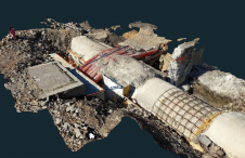
Data from BIM
While Singapore (and almost all cities globally) aims to maintain harmony and balance as a sustainable smart city, there is a need to identify what combinations of data and design realise the best outcomes in the physical world; specifically, data generated from simulations in the virtual world, and data observed from the physical world. Or to use technical terminology, one of the reasons to bring together data generated through the process of Building Information Modelling (BIM) with surveyed information and geospatial location and context.
The BIM-Geo interoperability challenge is vital to the research and development project we are working on – being led through a collaboration between the National University of Singapore (NUS) and Ordnance Survey. The project stems from a broader Smart Nation initiative within Singapore, for which we are developing a technical solution to enhance the data within the Virtual Singapore 3D integrated model – one of a number of enabling platforms for the Smart Nation.
Part of the lead up to this work was the creation of an initial data model for the Virtual Singapore 3D integrated model, based on the OGC CityGML data standard. The model is expected to become an important part of the shared digital data infrastructure of Singapore, and the motivation is that having a shared data platform will unlock alternative methods to deliver new applications and innovations, for example, in urban planning and building design, all so that citizens and residents can experience improved levels of comfort and living.
BIM data models provide one potentially valuable source of information, to enhance a ‘digital twin’. The challenge with ‘digital twins’ is to ensure their value extends beyond purely photorealistic visualisation, and much more towards providing a content-rich source of information that can be put to computational processing and workflows to deliver improvements across the operational context of cities, regions and even countries.
This project is not creating a digital twin. Rather, we are developing a component – including software and data standards – to automate the enhancement of information within the model so that more information, but specifically from source BIM data models, can be put to computational processes and workflows by the agencies and stakeholders of the model.
Research and Practice in Parallel
This project provides an opportunity to actively collaborate across a diverse set of stakeholders – city agencies and practitioners, the research community, data authorities, technology vendors and data standards bodies. Funded through the National Research Foundation (NRF), we are tasked with the delivery of a conversion methodology that will enable the automated enhancement and update to the virtual model, but specifically the buildings, their exterior and interior. The source data which contains the semantic and geometric information necessary to enhance the data model comes from native BIM data models – often, data generated in isolation, and solely within the virtual environment.
On the face of it, this is a data conversion exercise, to take information from source BIM data (actually, the starting place for the research is from Industry Foundation Class (IFC)) to CityGML. Enough research exists on IFC and CityGML interoperability however, which seems to indicate that the two formats are, at this time, largely incompatible. There are other factors, including the heterogeneity of source BIM data models, due to differing maturity levels of BIM adoption across the design and construction domain. For this level of research, this is down to the levels of variability in the design and modelling approaches and standards that are used to create the BIM models. Furthermore, good examples on the use and application of 3D geospatial data in the operational context of a city – relating specifically to multi-stakeholder data collaboration platforms – and the data requirements from such examples, are also at various stages of maturity and development.
Consequently, it becomes exceptionally challenging to make informed choices and decisions at the level necessary to define appropriate data specifications without knowing what is required and how it is going to be deployed.
This leaves us with two main approaches to drive the research and development activity and to define the data specifications and what information needs to be converted:
- Art of the possible – transfer all information from source to target data model
- Outcomes & value – transfer only what is necessary based on application and use cases
The approach we are taking on this project is a blend of the two. We are actively collaborating with the stakeholders and agencies throughout the development, combining design-driven development, discovery and user needs methodologies with pure research and development and iterating as we go – in a sense, a true agile approach, with discussion often focussed on whether better result outcomes are possible. It is perhaps slightly unusual to run a research project in this way, but it will ensure the delivery of outcomes that have immediate value and practical application for the stakeholders and agencies.
We are developing graph-based data transformation techniques as a core component of the technical solution. So far, this approach does not seem limited within any specific use-cases or applications and should enable a suitable level of configurability, which can be developed incrementally after project completion. The innovation here, lies not only in the combination of the approach being taken – the development of the research and the practical requirements in parallel - but also the creation of tooling and a data packaging specification, as part of a technical solution that could potentially support much broader usage and has transferable value into other smart city applications and use cases.
Limitations and Boundaries
Digital data infrastructure is becoming as much a part of the city as any of the physical features that make them unique and immediately recognisable identities to humans. Arguably, the patterns and data signatures that exist within a city’s digital infrastructure are likely to become the globally accepted standards which we use to identify and diagnose problems, and perhaps use to redefine the meaning of what cities are.
At the risk of sounding clichéd, we are on a journey. However, this journey, backed up by mounting scientific evidence, is in fact not so much a journey as a race against time, with some dire global consequences rapidly accelerating towards us. More effective use of data, for example, so that agencies, organisations and practitioners can monitor and predict performance against the UN Sustainable Development Goals, is a journey of significant challenges because it requires multi-stakeholder prioritisation and alignment in activities, requiring us to challenge the boundaries, silos and vertically fragmented systems that we have in place.
Boundaries may be useful in managing complexity across different agencies and stakeholders’ interests and responsibilities in the physical world, but the same boundaries may not be so useful when we transfer decision making processes into the virtual world. Technology adoption continues to accelerate at a pace that is leaving other, arguably equally important aspects of smart cities (people and processes) lagging behind. With too much continued emphasis on technology alone and in the hope of using the virtual world to realise a better physical world of tomorrow, we may inadvertently introduce the same limitations, boundaries and vertical fragmentation as we presently find in the physical world. Therefore, without some care, we risk arriving at a destination that is no different or better than where we are presently headed.
On a positive note, the implicit geographic properties we can embed within the digital world that can be used to identify patterns and digital signatures within a city, region or country, do not share the same limits or boundaries as the physical world. Their use, application, and therefore value, is potentially limitless, but only if we continue to do all we can to ensure that the focus remains on promoting use and creating value, and not on recreating the boundaries or limits we have in the current physical world.
We should think very carefully with regards to carrying ‘physical baggage’ into the digital and virtual.
------------------------------
Acknowledgements
This material is based on research/work supported by the National Research Foundation under Virtual Singapore Award No. NRF2015VSG-AA3DCM001-008.
All opinions, findings, conclusions and recommendations expressed in this material are those of the author and do not necessarily reflect the view of the National Research Foundation.
The original version of this article was published in Geomatics World.

Value staying current with geomatics?
Stay on the map with our expertly curated newsletters.
We provide educational insights, industry updates, and inspiring stories to help you learn, grow, and reach your full potential in your field. Don't miss out - subscribe today and ensure you're always informed, educated, and inspired.
Choose your newsletter(s)