How Drones are Future-proofing the Construction Industry
Flying High for More Data and Detailed Insights
Drones are enabling construction professionals to access more data and detailed insights to create the reliable, sophisticated design models that are needed to stay ahead of the competition.
It’s no secret that ensuring construction projects remain on time and in budget is crucially important for all stakeholders and demand continues to grow for faster, more readily available and up-to-date information. The goal? To optimise operational productivity and efficiency during projects and help the industry evolve and grow. Indeed, reports claim that if construction productivity were to catch up with the global economy, the sector’s value would increase by an estimated $1.6 trillion — and add approximately 2% to the global economy.[1]
Recent changes in legislative measures are driving change across the industry, however. Technological advances, such as the Building Information Modelling (BIM) framework, have significantly improved the way in which construction companies share information and data on a project and help to future-proof their operations. The introduction of unmanned aerial vehicles (UAVs), or drones, has also further facilitated this change. Drones have enabled construction professionals to access to more data and detailed insights to create the reliable, sophisticated design models that are needed to stay ahead of the competition.
Why drones?
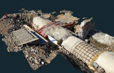
Drones are increasingly well recognised in the construction space as an important tool for collecting valuable data and insights during the construction process. Unlike traditional topographic methods, drones can cover large areas quickly and easily and generate detailed 3D imagery of the project site and surrounding area. For instance, carrying out a drone survey in the initial stages of a project can offer important benefits for both architects and customers, who can use the drone data to navigate the site in 3D before any construction starts. This can be invaluable for capturing current conditions and making subsequent design changes. Increasing the number of data points on a survey can also add significantly more accuracy to the planning phase. In road construction projects, for example, drones have proved efficient at making more precise stockpile material calculations. This data can help civil engineers to plot volumes of earth that require moving, as well as inform site managers of the number of resources needed, such as people, vehicles, supplies and services. By building a better picture of these requirements in the early stages, there is also an opportunity to save valuable costs and time across the lifespan of a project.
In addition to the extensive mapping and surveying prior to the start of construction, drones can also be deployed to assess ongoing activity and provide real-time insights for a broad range of stakeholders. Acting as a reliable monitor for construction site progress, a UAV can track progress and provide visibility regularly to the whole team, including surveyors and quality controllers. This data can be crucial for ensuring work remains on-track and allows project managers to implement any required changes as they arise, rather than carry out extensive rebuilding later. Together with tools such as Conflict Management, drone insights are helping to add further data points to design models, allowing for algorithms to automatically detect any errors in construction as they arise. Detecting potential issues soon as possible in the process is crucial to ensuring seamless workflows and reducing the cost impact to projects in the event of any necessary re-works.
Drones in action
As drones become increasingly integrated in construction projects, they can also help to provide improved accountability during the development process. Since a UAV can monitor sites daily, there can be plenty of documentation made available to refer to, should any errors be made. This accurate track of activity can help to monitor and prevent potential mistakes – ensuring quality, responsibility and effect cost-management throughout the project.
In addition to monitoring quality, UAVs have become an important tool for site management and improving safety processes, which remains a key issue in the industry. Thanks to their aerial data capture functionality, drones are proving key to minimising the need for high numbers of on-the-ground staff when mapping an area, helping to reduce the volume of health and safety hazards on active construction sites. Indeed, drones can navigate high-risk areas and monitor material, equipment and even people, to form detailed insights that can identify potential safety issues. For instance, ahead of deliveries of large-scale materials, UAVs can first check the clearance and positioning of certain equipment, check access road slopes and simulate the position of cranes to ensure safer, more seamless operations.
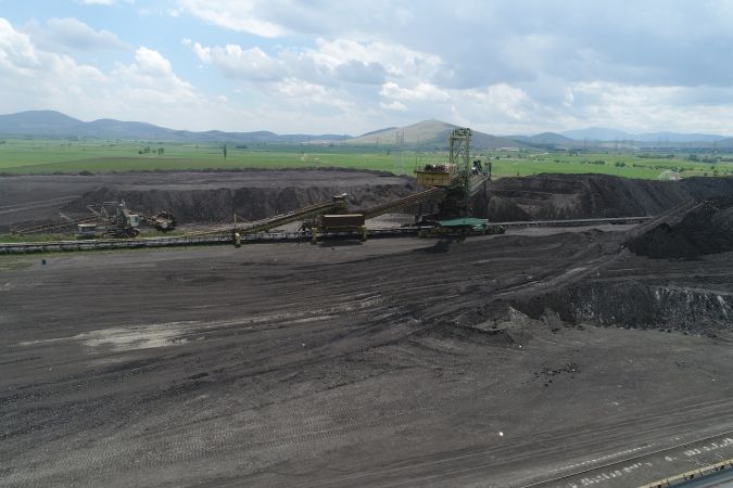
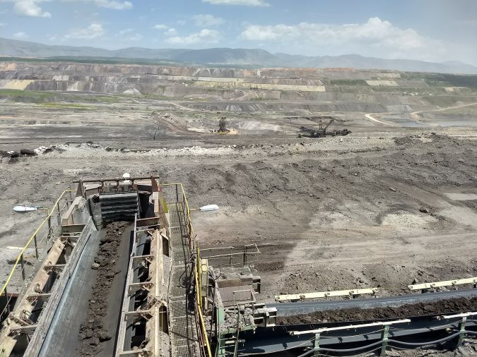
UAV technology also recently helped to add value to the mapping of an expansive construction site at a mine in Arizona spanning 630 acres, with highwalls reaching over 2,000 ft tall. The site was inaccessible using traditional methods, but using a drone allowed the team to monitor the pit walls for movement and any potential sloughing or deterioration. Using drone technology also enabled site traffic to continue as normal, without the need to temporarily shut down operations to allow surveyors access.
The right fit
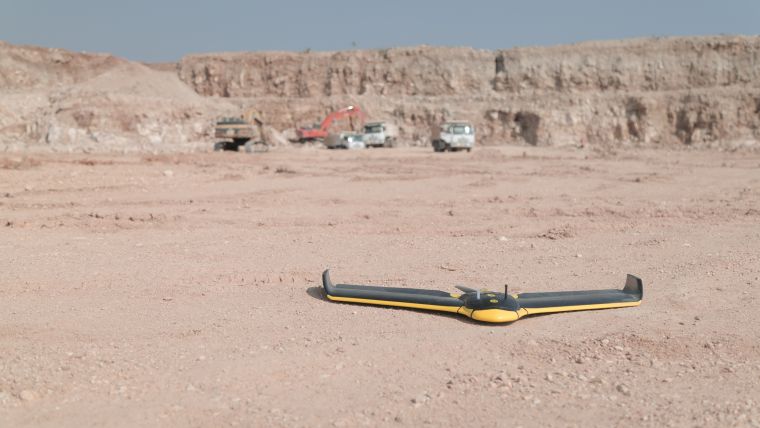
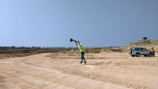
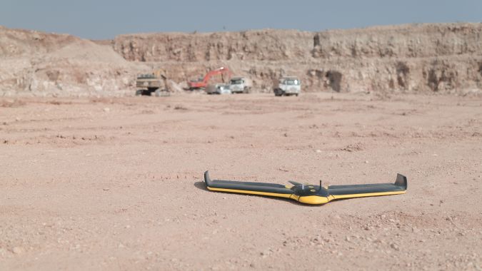
Innovation in drone technology has meant that fixed-wing UAVs are increasingly the hardware of choice for mapping larger, more expansive construction sites. The latest designs are capable of longer flight times, more range and improved mission capability, ensuring they are optimised for flight efficiency.
Advances in UAV technology have also seen fixed-wing drones become equipped for Beyond Visual Line of Sight (BVLOS) operations, which offers particular benefits in construction applications. Thanks to improved motors and safe airframes, which have been verified through rigorous impact testing, construction professionals can safely fly further, beyond their line of sight, and map larger areas to gain more data and insights in a shorter time. In addition to offering cost, time and operational efficiencies, this also opens up exciting opportunities in the construction space by paving the way for more complex operations. Greater public acceptance and scalability, facilitated by fit-for-purpose regulatory frameworks, will be key to making this a reality.
Although fixed-wing drones are already widely recognised for their benefits in mapping large, open spaces, they are a growing area of interest for construction professionals operating in dense, more urban environments. While adoption can be much slower, due to the stringent regulations surrounding, for instance, operations over people (OOP) and restricted airspaces like airports, when correctly managed UAVs bring valuable data from smaller sites in urban applications and their benefits are being increasingly recognised as legislation moves more in line with technology advances. Indeed, as UAVs become more widely implemented across the globe, it is likely that drones will be able to integrate more effectively with other airspace traffic, allowing a greater range of applications in the construction sector in the future.
Forward-thinking solutions
Fixed-wing drones present a cost and time effective option for construction companies, however to get even more detailed insights, at a higher resolution, professionals are increasingly exploring options with drone fleets, including both rotary and fixed-wing devices, which offer their own unique benefits. Rotary devices do not require a substantial landing and take-off area and can therefore benefit from improved manoeuvrability. Thanks to their ability to hover at close proximity to areas of interest, these drones are also ideal for operations where close proximity to an object is required. With several drones working together as part of a fleet, large quantities of data can be collected more quickly and enable teams to be more proactive. This can be particularly useful when working across multiple projects.
Aerial surveying methods can also be complemented with integrated software solutions, allowing users to both accurately map terrain and analyse the data afterwards. For instance, leading flight planning and management software allows teams to assess the feasibility of the project prior to each flight, so they can plan their route more effectively. Flight boundaries can also be outlined in advance, enabling take-off and landing zones to be pre-determined, which helps to increase efficiencies when in the field. By creating a link between drone and software, construction professionals not only facilitate the handling of data, but also ensure output is as fast as possible, a crucial factor in boosting project efficiency and profitability.
Furthermore, processes such as BIM, are only as good as the data that’s collected. By providing large amounts of reliable data from UAVs, including orthomosaics, digital surface models (DSMs) and detailed point clouds, stakeholders – including architects and site managers – can have access to powerful insights that offer a more up-to-date model of the site and add real value. This is crucial to enabling informed, data-driven decisions, and by utilising drone solutions that offer greater absolute accuracy – even without the use of ground control points (GCPs) – construction professionals can obtain valuable, reliable insights through highly accurate geo-rectified imagery quickly, efficiently and safely. By having access to 3D build models that are more detailed than ever before, together with collaborative tools like BIM, designs can be easily updated and modified. BIM workflows also continue to be simplified and optimised thanks to ongoing advances in platforms used to process drone data, which can now be rapidly uploaded, processed and made available on the cloud for additional time efficiency benefits. In short, drones present an opportunity to make the BIM model more efficient – data capture, processing and sharing has never been simpler, optimising workflows and ensuring the entire team are on the same page.
The right direction
UAV technology is rapidly gaining ground in the construction sector, but the need to integrate new tools can mean that uptake is often still slower than desired. While there is still knowledge to be gained, examples of how drones have helped improve workflows are helping to make this change a reality and broaden the opportunities available for constructions companies looking to build or expand their drone fleet. UAVs offer a cost-effective solution to help streamline operational efficiencies throughout the entirety of a construction project, by increasing profit margins and improving safety. By changing how data is made available and shared on construction projects, it is further driving innovation across the industry — and offering a range of possibilities for the future of mapping in the construction space.
[1] The McKinsey Global Institute, ‘Reinventing construction: a route to higher productivity’, 2017.

Value staying current with geomatics?
Stay on the map with our expertly curated newsletters.
We provide educational insights, industry updates, and inspiring stories to help you learn, grow, and reach your full potential in your field. Don't miss out - subscribe today and ensure you're always informed, educated, and inspired.
Choose your newsletter(s)