How to Speed up Stockpile Measurement with Drones
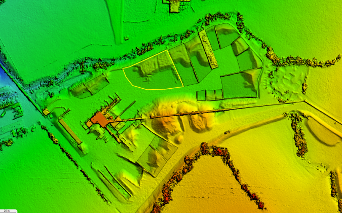
Unmanned aerial vehicles (UAVs or 'drones') are a powerful tool for stockpile measurement in industries such as mining, forestry and construction. They allow the same region to be flown regularly and progression of the work to be monitored over time. Imagery is collected over the region of interest at high resolution, often at the sub-centimetre level. Workflow advancements are now speeding up this process.
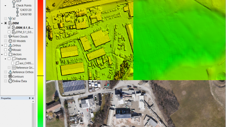
SimActive has recently released an enhanced workflow in its Correlator3D to accelerate stockpile measurement. The overlapping images are processed by the software to create a digital surface model (DSM), which accurately describes the topology of the terrain. Then, regions of interest can be created (or imported). Finally, automatic volume calculation is performed and outputted in comprehensive reports.
If the same area is regularly flown, the new workflow also allows to easily compare volumetric values to assess differences in time. As a first step, the software registers the different datasets to ensure a perfect alignment. Volume results from different image acquisitions can then be compared. Another option is to perform change detection within the software and automatically detect differences between DSMs. This allow to precisely quantity local variations in topography.

Value staying current with geomatics?
Stay on the map with our expertly curated newsletters.
We provide educational insights, industry updates, and inspiring stories to help you learn, grow, and reach your full potential in your field. Don't miss out - subscribe today and ensure you're always informed, educated, and inspired.
Choose your newsletter(s)