Indoor Mapping: We Have Only Seen the Beginning
Indoor mapping is often associated with the rise in location-based services, but over the past few years there has been a growing demand for indoor mapping for a much wider range of use cases. In fact, it is fair to say that the evolution of indoor mapping has only just got started. Read on to find out why.
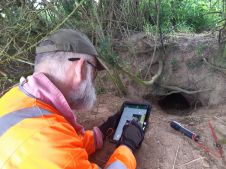
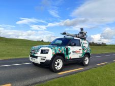
The biggest trend is that mobile indoor mapping is taking on more of the work traditionally performed by static laser scanners. Some of the earliest adopters of simultaneous localisation and mapping (SLAM) technology were surveyors and engineers. Faced with growing demand for ‘scan-to-BIM’ projects, this group in particular appreciated the speed and mobility that a mobile indoor mapping system could provide.
But the past year has marked a turning point, setting the stage for this emerging trend to become a real game-changer – in terms of both how indoor spaces are scanned and how that scan data is delivered and consumed. Three key developments have paved the way for what could be a monumental shift: improvement in the quality of the data, new deliverables, and new use cases.
Achieving survey-grade results with SLAM technology
First, the evolution and improvement of SLAM technology means that data captured by mobile devices is in some cases already achieving survey-grade results. SLAM originated in robotics and is one of the core technologies powering self-driving cars and augmented reality applications. Big names in tech like Apple, Google and Facebook have invested heavily in developing SLAM; analysts estimate that the global market for SLAM will be worth over US$8 billion in the next decade.
SLAM is also being used to improve mobile indoor mapping. The enhancement in data quality as a result of improvements in SLAM technology means that surveyors can use mobile devices for an even greater number of applications. Static scanners will continue to play an important complementary role, but an increasing portion of scanning projects will be done by mobile devices that can deliver high-quality data.
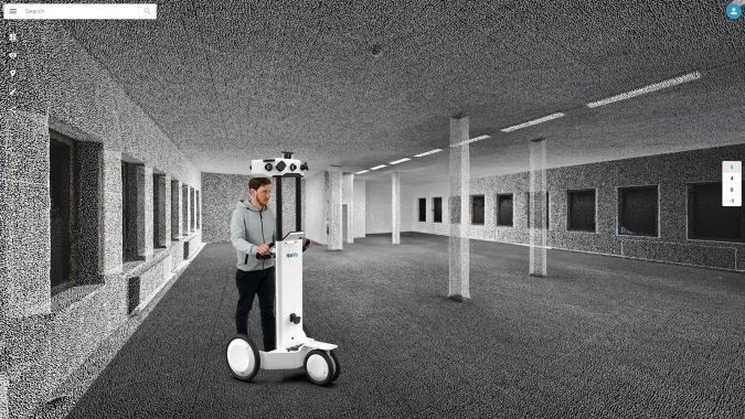
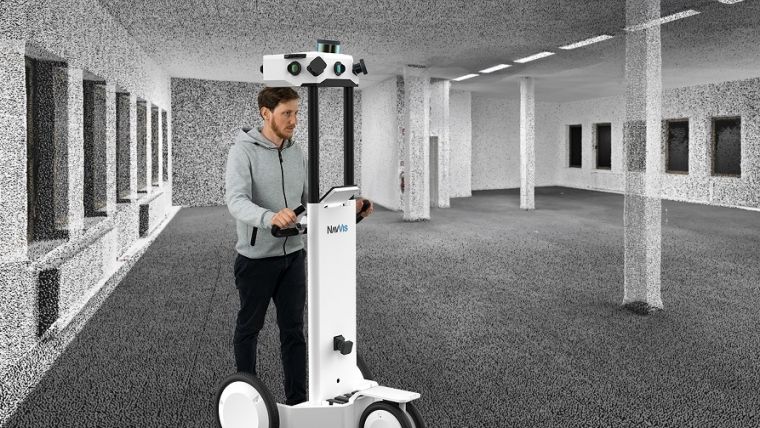
The second development is that indoor mapping offers surveyors not just faster data capture, but also rich new deliverables. Point clouds tend to be limited to professionals who are tasked with creating floor plans and BIM models. The new generation of software tools delivers this valuable scan data as HD maps and realistic, interactive ‘digital twins’. This type of web-based deliverable lets users interact with the scan data as if they were walking around the site, making it far more intuitive. The cumulative effect is that a much broader customer base can make use of this valuable scan data, not just those who know how to use CAD software.
Broader consumer base
That brings us on to the third development, which is that realistic, interactive digital twins open up a myriad of new use cases. Laser scanning captures incredibly valuable details. Making that detailed data available in a format that can be consumed by a broader customer base is going to increase demand for this technology. We have already started to see this happen; for professionals ranging from factory planners to facility managers, high-definition, detailed visualisations provide them with valuable spatial intelligence that can be used on its own or integrated into existing software systems. The benefits are also increasing along with the applications, and have resulted in significant time and cost savings by reducing international travel, facilitating the remote sharing of best practices and increasing collaboration.
Therefore, as indoor mapping technology continues to advance, it will result in many more stakeholders benefiting from a digital version of their buildings.
Felix Reinshagen is co-founder and CEO of NavVis, a company specialised in indoor mapping. In April 2018 they launched a new version of their indoor mobile mapping system, which is powered by next-generation 6D SLAM.

Value staying current with geomatics?
Stay on the map with our expertly curated newsletters.
We provide educational insights, industry updates, and inspiring stories to help you learn, grow, and reach your full potential in your field. Don't miss out - subscribe today and ensure you're always informed, educated, and inspired.
Choose your newsletter(s)