Taking Full Advantage of the Benefits of UAS Technology
Leveraging UAS technology across surveying and engineering sectors is demanding. Meeting the expectations of accuracy and accountability requires the best in expertise, methodology and equipment. The latest unmanned aerial system (UAS) photogrammetric hardware and software now enables surveyors to capture millions of survey measurements on the ground, where they would previously have measured only hundreds. It is essential to have the best-quality equipment, software and workflows to ensure this data is accurate, robust and defensible for professional use.
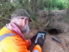
Geosyntec is a leading consulting and engineering firm that works with private and public sector clients to address new ventures and complex problems involving our environment, natural resources and civil infrastructure. UAS technology is becoming a key complement to the innovative technical solutions Geosyntec provides to its clients. From initial site inspections, engineering design and analysis to improving construction quality assurance and project earthwork productivity assessment, leveraging in-house high-accuracy UAS mapping capabilities is proving to be invaluable in countless projects.
Powerful toolkit for professional mapping applications
Setting up the right UAS photogrammetry mission framework is essential for success. This includes quality survey grade equipment and software. Geosyntec sees KlauPPK as an integral part in bringing this all together. This system includes a high accuracy PPK system, calibrated camera, and post processing software to manage PPK processing with 3D lever arm corrections, coordinate systems, and field QC checks.This combined with quality survey-grade Trimble GNSS hardware and software, UgCS mission planning software, Pix4D photogrammetry processing, raw terrain post processing with Virtual Surveyor, and final analysis with Autodesk Civil 3D, all combine into a powerful toolkit for professional mapping applications.
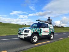
Frontier Precision has played a big part in supporting Geosyntec to find the right choices in survey technology, including GNSS survey equipment from Trimble and Klau Geomatics. For decades, Frontier has helped surveyors and engineers with quality survey technology.
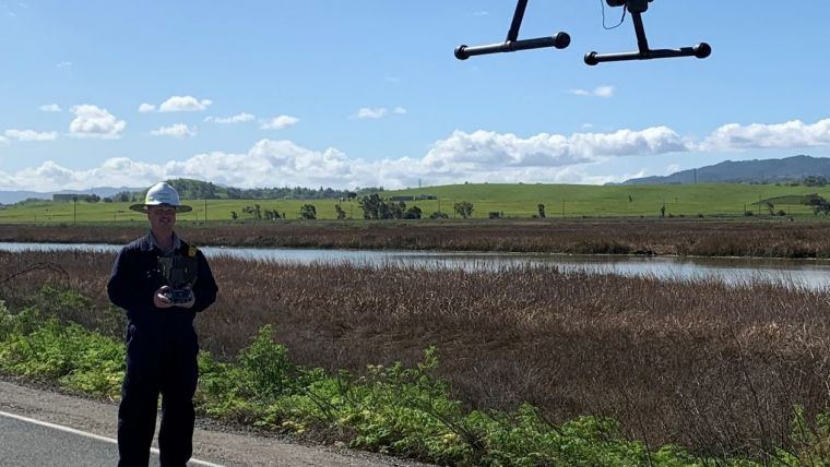
Geosyntec continues to embrace the latest UAS technology in their progressive roadmap. They will soon be testing the latest from Klau Geomatics, which includes NovAtel Terrastar-C Pro PPP technology, cloud-based post processing, and a custom gimbal/trigger system to enable a Sony RX1R2 42 MP camera on their DJI Matrice 200 Drone.
“We continue to stay at the cutting edge of UAS and GNSS technology applications, which is essential to keeping our business advantage in the AEC industry," said Michael Carlson, project geospatial scientist, of Geosyntec Consultants, based in San Diego, California.

Value staying current with geomatics?
Stay on the map with our expertly curated newsletters.
We provide educational insights, industry updates, and inspiring stories to help you learn, grow, and reach your full potential in your field. Don't miss out - subscribe today and ensure you're always informed, educated, and inspired.
Choose your newsletter(s)