The 123 of AEC: Renewing the Architecture, Engineering and Construction Industry with Satellite Imagery
A recurring sustainable issue faced by the architecture, engineering and construction (AEC) industry is that of green buildings. The global market for green construction is projected to reach US$364.6 billion by 2022. The demand for this kind of minimally invasive construction design will not only increase over the next 25 years, but is also set to significantly alter the industry. Combined with population growth, a challenge now exists for AEC professionals to create innovative designs that are both economical and sustainable in the long term. Incorporating very high resolution (VHR) optical satellite imagery into the planning and development stages of any AEC project can provide solutions.
(This article is brought to you by European Space Imaging)
The use of remote sensing and Geographical Information System (GIS) technology in AEC applications gives enormous benefits over traditional in situ data collection. The data is obtained in a timelier manner, is cost efficient, highly accurate and geospatially reliable.
Furthermore, the combination of data from optical satellites with other socio-economic data provides a crucial link in the total planning process via building information models (BIM), imparting the necessary insights to make effective planning decisions throughout the building’s life cycle.
VHR optical satellite imagery can be an essential tool to monitor site progress, map development portfolios and identify green space. It offers a non-destructive means of providing recurrent information from both a local and global scale. By combining data sources with artificial intelligence and machine learning, further insights can be gained autonomously and in a timelier manner. Advances in these technologies are increasing the affordability for most users, making the exploitation of remote sensing reliable and profitable.
Other areas where VHR optical satellite imagery can provide benefits include building extraction and delineation, impervious surfaces detection, infrastructure modelling, environmental impact monitoring, urbanization morphology and 3D modelling.
The following article will give an overview of how the AEC industry can benefit from the use of VHR satellite imagery.
Preconstruction Planning
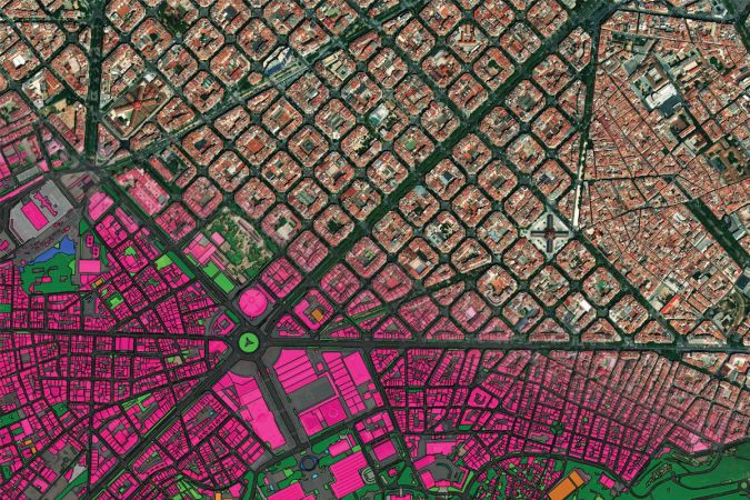
VHR satellite imagery is a useful tool to scout potential project sites during the feasibility and planning stages. Combining the imagery with AI unlocks a world of possibilities. Structured georeferenced interpretation of the geometric footprint of each building can be extracted to verify addresses and points of interest. This can provide insights into the wealth of neighbourhoods to determine profitable development sites. Additionally, from VHR data it is also possible to produce vector maps that contain features pertinent to your project such as roads, pavements, green space, railways, water and much more.
Construction Site Terrain
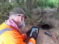
The topography and physical features of AEC projects should be considered in the preconstruction planning phase. This influences the layout of temporary facilities, best points of access for heavy vehicles and construction site safety planning. It is widely known that the major cause of delays in any construction project stems from construction site conditions resulting from insufficient preconstruction site surveys. This not only leads to schedule delays but also increases labour costs.
Many technologies that are used for generating digital models of site terrain rely extensively on project site surveys. These technologies are both time-consuming and costly. However, 3D representation of a terrain’s surface in digital format can be efficiently and cost-effectively generated from triple stereo data acquired through Very High Resolution satellite imagery. The imagery can be collected in a single acquisition and delivered in near-real time to generate a highly accurate Rapid Digital Elevation Model (DEM).
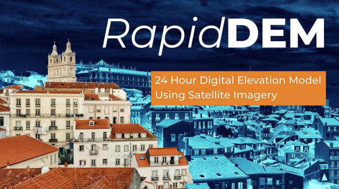
The use of DEMs is critical to making informed decisions in relation to design and planning of preconstruction operations. When taking into account the cost of equipment and data processing of traditional ground surveys, remotely sensed DEM’s can cut costs by as much as 10 - 30 %.
Infrastructure & Asset Management
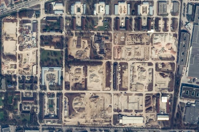
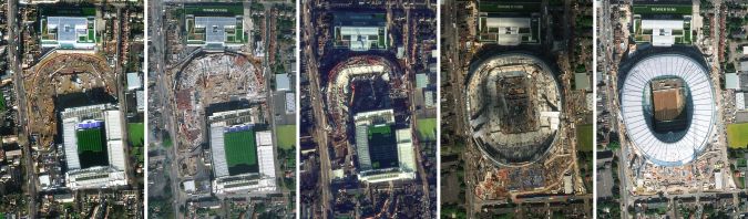
Satellite imagery can be used to monitor the surrounding environment and building assets during the construction phase. By utilising satellite imagery, Project Managers can remotely monitor large property portfolios automatically without leaving the office. The detail in the imagery can provide a clearer understanding of the projects progress, detect risks of natural hazards and mitigate environmental impacts. The imagery offers scalability and reduces the need for on-ground personnel to physically inspect construction sites. This enables enormous cost-savings and provides key insights to decision makers in near-real time for operational risk management as well as asset management. Additionally from the data, it is possible to gain global insights into competitor projects and urban developments.
Monitoring Green Space
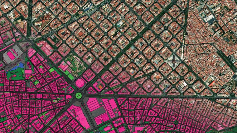
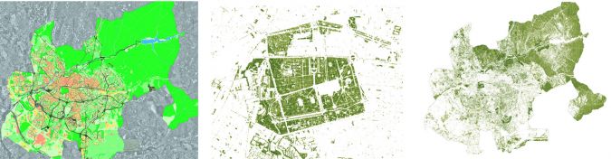
One of the key components of sustainable building is green spaces. The use of NDVI index from satellite imagery aids urban planners in quantifying green spaces. Monitoring these areas is important for change detection to ensure that landscape ecology principles are upheld. Within recent years, the City Council of Madrid has prioritized green area monitoring and change detection, recognising that vegetation will help reduce the effect of the city’s Urban Heat Island (UHI), the phenomenon that causes a city and its environment to be significantly warmer than the surrounding countryside due to human activity.
Aware that they could measure and monitor plant growth, vegetation cover and biomass production from multispectral imagery and thereby determine the city’s Normalised Difference Vegetative Index (NDVI), they turned to WorldView-2 data provided by European Space Imaging and analysed by their partner Indra, to tackle the issue. This enabled a methodology to be established that takes into account not only NDVI, but Fractional Vegetation Cover (FVC) as well. These indices helped to define structural properties of the plant canopy that are relevant for a wide range of land biosphere applications, such as environmental management and land use. Furthermore, it can provide crucial measurements as cities strive to develop green space to improve quality of life and reduce the potential hazards of climate change and human activity. The methodology created provides ongoing information for both protecting existing green space and identifying new opportunities.
Road Networks
Transportation systems are pivotal in rapid modernisation. When it comes to AEC, it is necessary to implement a strategic plan to avoid traffic congestion and pollution whilst ensuring interconnectivity of the population and ease of access for all vehicles. Insights into road patterns, width and alignment in addition to items such as dividers, sidewalks and gutters can be obtained from satellite imagery. When combined with land and parcel information, potential sites for new roads and rail infrastructure with the least environmental impact can be determined.
Conclusion
European Space Imaging has over 15 years’ experience working closely with a number of authorities and private companies within architecture, engineering and construction. Whether it is delivering archive data or planning fresh acquisitions, the team is available to assist a wide range of urban planning applications to ensure your planning goals are met.

Value staying current with geomatics?
Stay on the map with our expertly curated newsletters.
We provide educational insights, industry updates, and inspiring stories to help you learn, grow, and reach your full potential in your field. Don't miss out - subscribe today and ensure you're always informed, educated, and inspired.
Choose your newsletter(s)