Topcon Unveils New Technology Advancements in Inspection and Monitoring
Topcon Positioning Group has announced advancements in its inspection and monitoring portfolio designed to ensure longer term health of buildings and infrastructure assets. Among the improvements announced at Intergeo 2019 include new flight planning software for the Topcon rotary-wing UAV; mass data photogrammetry processing integration capabilities, as well as the release of Delta Link version two, the new command console for the Topcon construction and structural health monitoring system.
“Inspection, assessment and monitoring (IAM) is a crucial cycle to ensure the integrity of building assets. Topcon IAM solutions help to keep assets in operation, providing intuitive tools for site engineers to perform inspection and if any concerns are detected, a monitoring program can be implemented. The integrated approach ensures maximum performance of the infrastructure assets in a safe environment for operators and the public,” said Ian Stilgoe, vice president GeoPositioning Europe, Topcon Positioning Group.
Direct access to UAV and inspection analysis
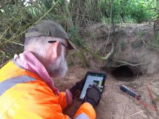
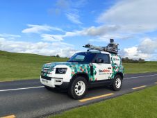
New Intel Mission Control Software is designed to facilitate automated flight planning, managing missions, and data handling for the Topcon rotary-wing UAV offering. The software is designed to increase accuracy with advanced mapping features that allow site engineers performing aerial inspections to easily set project parameters and prepare missions using presets for 2D areas like polygons, corridors and city grids, as well as 3D structures like towers, buildings and facades.
UAV operators can also take advantage of new cloud-based photogrammetry processing, powered by Bentley ContextCapture, in the MAGNET Collage Web 2 service for publication, sharing, and analysis of data. The integration allows users who share and collaborate with scanning and mesh datasets to process and add UAV photos directly to the environment. The cloud-based approach is designed to ensure that stakeholders have direct access to UAV and inspection analysis of their assets without the need to install software or have a high-performance computer.
Data from multiple devices
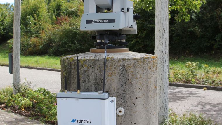
The new Delta Link version two provides communications support for Topcon autonomous construction and structural health monitoring in the field. Options include Ethernet, Wi-Fi, and a globally approved integrated cellular modem. The system manages each power source, maximizing system availability.
“If concerns are discovered during inspection and analysis, operators can take advantage of the monitoring system to provide deeper understanding of the asset and improve safety,” said Stilgoe. “The system allows data from robotic total stations, GNSS receivers, leveling devices and a variety of geotechnical and structural sensors to monitor and ensure structural health.
“Advanced long-term structural health maintenance is becoming more and more critical due to an aging infrastructure, increasing population, growing urban environments and a need for more housing. Always one step ahead, Topcon is committed to delivering the innovations and integrated workflows, such as IAM, that transform the way we build and maintain infrastructure,” said Stilgoe.
More information about Topcon is available at topconpositioning.com.

Value staying current with geomatics?
Stay on the map with our expertly curated newsletters.
We provide educational insights, industry updates, and inspiring stories to help you learn, grow, and reach your full potential in your field. Don't miss out - subscribe today and ensure you're always informed, educated, and inspired.
Choose your newsletter(s)