Pointfuse Launches Simple BIM Solution for Facilities Management
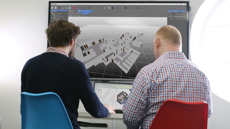
Pointfuse has developed smart software that automates the identification and classification of objects for facilities management applications using data from mobile mapping systems like the new Leica BLK2GO. The software converts the millions of individual measurements captured by laser scanning and photogrammetry into usable 3D mesh models. The ability to classify objects within Pointfuse, both automatically and manually, has brought new possibilities in how as-built data is used within design and construction.
The software solution now can realize real time records for space utilization and optimization projects, reducing costs and speeding workflows within facilities management. Pointfuse ‘Simple BIM’ (sBIM) leverages the core functionality of Pointfuse – the segmented mesh model; automatically converting classified mesh models into ‘family’ groups, such as walls, floors, doors, windows, etc. for use with popular downstream BIM and FM software. Pointfuse sBIM data can then be exported as IFC (Industry Foundation Class) parametrized objects and 2D floors plans and space management reports easily derived. Pointfuse sBIM also automatically calculates quantities, areas and dimensions in an easy to read PDF report.
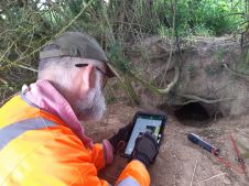
Handheld indoor mapping systems
“This ability to convert classified objects into family place holders has a huge impact on how as-built data is used within a Scan2BIM workflow with the potential for a real return on investment for facilities and space management applications,” commented Mark Senior, regional sales director at Pointfuse. “The combination of ease and speed of data capture, as offered by modern handheld indoor mapping systems like the newly launched Leica BLK2GO, with the automation of Pointfuse processing will release the potential of laser scanning across this sector.”
Pointfuse sBIM was developed in response to a large-scale client opportunity that saw the scanning of millions of square feet of facilities with the final deployment of data in Archibus facilities management software using Autodesk Revit as a bridge. Early testing identified that 3D was as quick to create as traditional 2D workflows and exported data is in the region of hundreds of Kbs compared to the Gb volumes of the original point cloud. Taking the process one step further Pointfuse provides an accurate record of the as-built scene by allowing users to create Hybrid meshes combining Pointfuse models with the sBIM IFC container.

Value staying current with geomatics?
Stay on the map with our expertly curated newsletters.
We provide educational insights, industry updates, and inspiring stories to help you learn, grow, and reach your full potential in your field. Don't miss out - subscribe today and ensure you're always informed, educated, and inspired.
Choose your newsletter(s)