From Real World to CAD
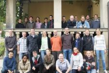
The company kubit develops software for surveying and as-built documentation, most of which works in conjunction with Autodesk software as third-party plug-ins. With its global headquarters located in Dresden, Germany,...
The company kubit develops software for surveying and as-built documentation, most of which works in conjunction with Autodesk software as third-party plug-ins. With its global headquarters located in Dresden, Germany,...
Safe Software has enabled the City of Santa Rosa (US) to implement an integrated water and sewer asset management system by eliminating complex and time-consuming CAD and GIS data integration...
MiniCAD 5.1 is available for download from the Mapsoft website. The new version has been improved compared to the earlier edition. MiniCAD 5.1 is capable ofFull unit internationalisation of product...
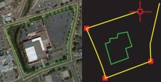
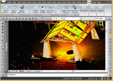
The Point Cloud CAD 2010 is Microsurvey's latest product that allows the individual to work with Point Cloud and LIDAR data with ease. MicroSurvey has spent the last year working...
Autodesk has announced that Dotted Eyes has become an official Autodesk partner. As a Value Added Reseller (VAR), the company will initially concentrate on selling AutoCAD Map 3D, the leading...
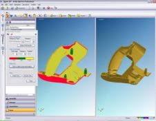
More and more companies in the manufacturing industry are searching for solutions that enable them to visualise CAD files in all areas of the organisation, without requiring an expensive CAD...
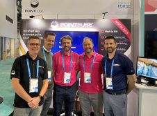
Pointfuse has signed a reseller agreement with one of the largest Autodesk and Leica Geosystems distributors in the USA. California-based U.S. CAD is an AEC technology consultant with 20 years’...
It’s been three and a half years since I joined Cadline as a GIS Application Engineer, and my new job title was probably the first sign that I was now a...
MicroSurvey Software has released MicroSurvey CAD 2017. This updated solution for land surveying and civil engineering professionals worldwide contains several powerful new and enhanced capabilities, streamlined workflows and important bug...
This site uses cookies. By continuing to use this website, you agree to our Cookies Policy. Agree