DJI ENTERPRISE
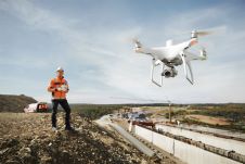
Land Surveying Drone solutions collect accurate, geo-tagged data quickly, while photogrammetry software processes these data to deliver standardized outputs. Learn how drones elevate land surveying Urban Planning Drone data creates...

Land Surveying Drone solutions collect accurate, geo-tagged data quickly, while photogrammetry software processes these data to deliver standardized outputs. Learn how drones elevate land surveying Urban Planning Drone data creates...

DJI, a civilian drone and aerial imaging technology company, has introduced DJI Terra, a software tool that transforms drone data into digital 3D models and maps for easy analysis and...
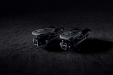
DJI has introduced its new DJI Mavic 3 Enterprise series designed to reimagine what drones can do for business, government, education and public safety. The DJI Mavic 3E and DJI...
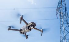
DJI, a world leader in civilian drones and aerial imaging technology, has unveiled the Mavic 2 Enterprise - a portable drone which features an ultra-compact and foldable design with an...

DJI, a world leader in civilian drones and aerial imaging technology, has announced the global rollout of the Phantom 4 RTK, a high-precision aerial survey drone that combines centimetre-level navigation...

Intergeo 2023 was an electrifying three-day event in Berlin, transforming the city into the global geospatial capital. From 10-12 October, professionals from across the globe convened for the world’s premier...
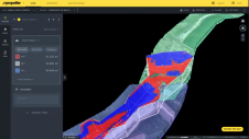
Propeller Aero and DJI have expanded their partnership to include compatibility of Propeller’s site surveying and 3D mapping software with DJI’s Matrice 300 RTK drone (M300) and Zenmuse P1 sensor...

With the 3D models generated from DJI Terra and P4 RTK, a Japanese city can now create digital twins and preserve every little detail on the construction of a centuries-old...

Klau Geomatics has released a new mapping payload for DJI M3000 that weighs just under 1 kilogram. A KlauPPK module mounted via the Klau Geomatics Sony gimbal connects straight into the...
DJI, a global leader in civilian drones and aerial imaging technology, and Delair, a leading provider of visual data management solutions for enterprise, are partnering up to collaborate on enhanced...
This site uses cookies. By continuing to use this website, you agree to our Cookies Policy. Agree