New UN organization to highlight the value of geodesy
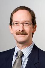
The brand-new United Nations Global Geodetic Centre of Excellence (UN-GGCE) is now operational at the United Nations campus in Bonn, Germany. Nicholas Brown, head of office of the UN-GGCE, is...

The brand-new United Nations Global Geodetic Centre of Excellence (UN-GGCE) is now operational at the United Nations campus in Bonn, Germany. Nicholas Brown, head of office of the UN-GGCE, is...

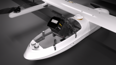
Inertial Labs and Sony have joined forces to develop an advanced Lidar system tailored for Sony's Airpeak drone. This collaboration aims to enhance drone capabilities in applications such as surveying,...

In the ever-evolving landscape of climate change, geospatial science emerges as a key player in navigating the complexities of our transforming world. The European Association of Aerial Surveying Industries (EAASI)...

Despite some uncertainty, there is renewed interest in drones, and remote sensing technologies are being embraced by smaller survey companies. Read these and other findings from our annual industry survey!...

Dedicated to the world’s tomorrow, Trimble is a technology company delivering solutions that enable our customers to work in new ways to measure, build, grow and move goods for a...

3D visualization is at the heart of many geospatial data applications. Progress in 3D visualization has drastically reduced barriers to entry for new products based on large datasets, thanks to...

As we enter the era of smart manufacturing, the reliability of data is growing in significance and data standardization is becoming increasingly important. According to JP Kelly, associate director and...
JOUAV has released the JoLiDAR-1000 Lidar sensor designed specifically for uncrewed aerial vehicles (UAVs or ‘drones’) as the latest addition to its array of high-performance Lidar sensors for use in...

A topobathymetric Lidar survey was conducted to support flood preparedness in Canada. Which techniques achieved exceptional precision, and what were the logistical challenges? Find out more in this article. As...
Urs Hugentobler is a professor of Satellite Geodesy and heads the Satellite Geodesy Research Facility of the Technical University of Munich, which operates the Geodetic Observatory Wettzell together with the...
This site uses cookies. By continuing to use this website, you agree to our Cookies Policy. Agree