Bluesky’s MetroVista powers Nottingham’s digital twin
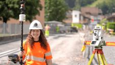
The city of Nottingham has taken a significant stride towards realizing its vision of establishing a digital twin for the city. In what is believed to be a pioneering initiative...

The city of Nottingham has taken a significant stride towards realizing its vision of establishing a digital twin for the city. In what is believed to be a pioneering initiative...
Our fast-changing world demands aerial cameras that are more productive, versatile and cost effective. The WARP Omni convertible camera is engineered to be highly competitive with satellite and UAV imaging, allowing you to leverage your expertise in aerial mapping for a broader range of applications. Our fast-changing world demands aerial cameras that are more productive, versatile and cost effective. The WARP Omni convertible camera is engineered to be highly competitive with satellite and UAV imaging,...

As the host city of Intergeo 2023 this October, Berlin promises to deliver the perfect kick-start for the geospatial industry in these rapidly changing times. The vibrant German capital is...
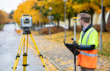
Although the essence of surveying has barely changed since the profession began, the increasingly complex digital continuum requires geospatial professionals to adapt their skills in dynamic and important ways, writes...
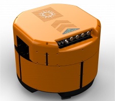
Which factors contribute to the slow adoption of TLS in Nigeria? These insights can help to stimulate the uptake of instrumentation and enhance professional surveying in other developing countries across...
In the first episode of NavVis’ new podcast series, we hear revelations from world experts about the past, present and future of reality capture and documentation. In the first episode of NavVis’ new podcast series, we hear revelations from world experts about the past, present and future of reality capture and documentation. ‘Scanning Realities’ is the...
In the early days of surveying, surveyors were pioneers in charting the unknown. Today, with the Earth having been completely mapped to some degree, surveying has become a much more...

The use of Lidar in the offshore wind industry is providing valuable insights into avian interactions with wind turbines. Lidar technology has already made its way into consumer devices such...

The city of Zagreb has been developing a semantic 3D city model since 2008. The city spatial planning sector was recognized as the main project user and developer, while more...
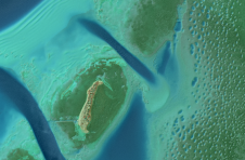
A decade after completing its first shoreline mapping project, NV5 Geospatial has mapped over 10.5 million hectares of North America’s shoreline and riverine environments for more than 200 projects. These...
This site uses cookies. By continuing to use this website, you agree to our Cookies Policy. Agree