Found 6728 results
Sort by

Pix4D Releases New Version of Pix4UAV

Pix4D, Switzerland, has announced the release of version 2.2 of its Pix4UAV desktop software. Pix4UAV is a software package that combines thousands of aerial images taken by lightweight flying platforms...

Read more

Woolpert acquires Murphy Geospatial

Woolpert has acquired Murphy Geospatial, a multidisciplinary geospatial solutions company that is headquartered in Kilcullen, Ireland. Murphy Geospatial is a private, family-owned company that delivers a broad range of services...

Read more

Autonomous Mapping with Pix4D

Making use of DJI’s new DJI Phantom software development kit, Pix4D has developed the first mapping app: the Pix4Dmapper mobile app allows drones such as DJI Phantom 2 Vision to...

Read more

Quadcopter Manufacturer Invests in Pix4D

Pix4D, Switzerland, has agreed on a CHF2.4 million investment from the Parrot Group to accelerate the development of its successful Mapping and Geographical Information System (GIS) software for Unmanned Aerial...

Read more

How mapping experts built the biggest 3D dataset of Alcatraz Island

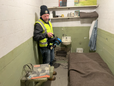
The rugged 22.5-acre site of the notorious US island prison Alcatraz has been digitally captured in a world-leading project involving multiple mapping technologies. With the team camped in the jail’s infamous cells for three weeks during the cold San Francisco winter, this historically, biologically and architecturally important location was recorded in unprecedented 3D detail. We discussed the project with project head Pete Kelsey and team member Dr Jeremy Sofonia. The rugged 22.5-acre site of the notorious US island prison Alcatraz has been digitally captured in a world-leading project involving multiple mapping technologies. With the team camped in the jail’s infamous cells...

Read more