Positioning Systems
Outdoor positioning and navigation techniques using GNSS have been well explored and are now a vital part of daily life all over the planet. Since GNSS was initially designed to...

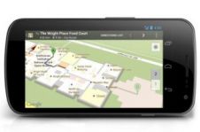
Wouldn’t it be great if we could find our way around anywhere and at any time using a small in our hand, pocket or bag? What a relief it would...
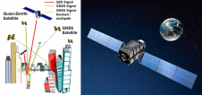
Nowadays, GNSS receivers have scores – and often hundreds – of channels, enabling them to track GPS, Glonass, Galileo and Compass signals simultaneously. The whole workflow from satellite tracking to...
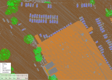
Blue Marble Geographic’s flagship software, Global Mapper Pro, is an all-in-one GIS package for analysing and processing vector, terrain, image and point cloud data. Compatible with over 380 different file...

Kyla Gao is a key contributor in e-commerce operations at ComNav Technology, a company specialized in the development and manufacturing of GNSS OEM boards, receivers and solutions for high-precision positioning...

The revolutionary use of active GNSS control points and cutting-edge geomatics equipment is setting new standards for accuracy in the construction of high-rise architecture, as demonstrated by this skyscraper project...

Both vertical and oblique aerial images have their own advantages, making them valuable in different reality mapping applications. So how can you choose between the two? This comparison will help...
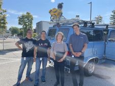
It can still be difficult to achieve centimetre-level accuracy in mobile mapping, especially in GNSS-denied or challenging areas such as in deep urban canyons, under foliage or through tunnels. However,...
This site uses cookies. By continuing to use this website, you agree to our Cookies Policy. Agree