UAS Campus Survey Project
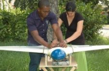
Texas A&M University-Corpus Christi, home to the largest geomatics undergraduate programme in Texas, USA, is currently undergoing a major university expansion. Both the main Island campus and the Momentum campus,...
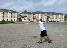
Texas A&M University-Corpus Christi, home to the largest geomatics undergraduate programme in Texas, USA, is currently undergoing a major university expansion. Both the main Island campus and the Momentum campus,...
The first UAS technical symposium sponsored by the American Society for Photogrammetry and Remote Sensing (ASPRS) has announced that industry leaders in the UAS commercial industry are on board for...
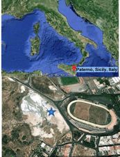
Insight into signs that prelude volcanic eruptions is key for protecting the lives, livestock and property of those living in the vicinity of a volcano. One key indicator is temperature...
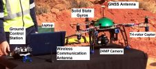
A UAS intended for mapping, inspection or reconnaissance consists of a mix of elements including aircraft, a ground control station (GCS), on-board navigation sensors, a radio link for manual control...
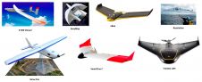
In recent years, unmanned aerial systems (UAS) have attracted tremendous attention from surveyors and other geodata collectors all around the world. Nowadays, UAS equipped with GNSS, IMU and RGB, NIR...
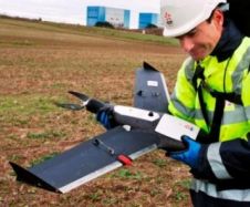
The popularity of unmanned aerial systems (UAS) is on the rise in many countries for a multitude of applications. In one such development, the UAS is rapidly becoming a tool...
Heavy rainfall in late May and early June 2013 caused the Elbe, Vltava and Kamenice rivers to burst their banks in the Czech Republic. Among other areas, the Troja area...
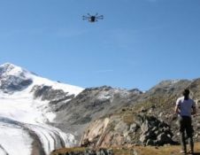
Alpine areas challenge the ingeniousness of humans in designing and performing airborne surveys. There is little space for navigation and poor reception of GNSS signals, while steep slopes cause large...
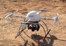
Monitoring a nuclear power plant construction site requires regular collection of site data; even up to weekly coverage may be necessary. Conventional photogrammetry and land surveying are often too costly....
This site uses cookies. By continuing to use this website, you agree to our Cookies Policy. Agree