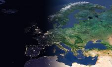
Why hasn’t the Earth observation industry taken off?
The Earth observation industry seems to be on a slow burn – but why? Brace yourself for a ‘rollercoaster ride’ through Earth observation as this article unravels the mysteries behind...

The Earth observation industry seems to be on a slow burn – but why? Brace yourself for a ‘rollercoaster ride’ through Earth observation as this article unravels the mysteries behind...
EuroGeographics is drawing attention to the indispensable role of official national geospatial data in enhancing Copernicus Services, particularly within land monitoring and emergency management. This highlights a reinforced partnership between...

Despite some uncertainty, there is renewed interest in drones, and remote sensing technologies are being embraced by smaller survey companies. Read these and other findings from our annual industry survey!...

The brand-new United Nations Global Geodetic Centre of Excellence (UN-GGCE) is now operational at the United Nations campus in Bonn, Germany. Nicholas Brown, head of office of the UN-GGCE, is...

The Australian government has committed to participating in Landsat Next, a groundbreaking satellite initiative spearheaded by NASA and the US Geological Survey. This programme aims to comprehensively map and monitor...

The Faroese Environment Agency, responsible for national mapping activities including land mapping and hydrographic surveying, has recently joined EuroGeographics, the representative body for European national mapping, cadastral and land registration...

SI Imaging Services (SIIS) is gearing up for the launch of an innovative 100%-commercial optical satellite with high-end resolution capabilities. This strategic initiative, in collaboration with its parent company Satrec...

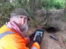
Inertial Labs and Sony have joined forces to develop an advanced Lidar system tailored for Sony's Airpeak drone. This collaboration aims to enhance drone capabilities in applications such as surveying,...

3D visualization is at the heart of many geospatial data applications. Progress in 3D visualization has drastically reduced barriers to entry for new products based on large datasets, thanks to...
RSK Group has awarded a new enterprise GIS contract to Esri UK to boost the use of geospatial technology across its operations and support ambitious growth plans. This three-year agreement,...
This site uses cookies. By continuing to use this website, you agree to our Cookies Policy. Agree