GEO Business 2024: unlocking geospatial innovation at ExCeL London
GEO Business, the UK’s premier geospatial event, is celebrating its tenth anniversary when it returns to ExCeL London on 5 and 6 June 2024. This edition promises to be the...

GEO Business, the UK’s premier geospatial event, is celebrating its tenth anniversary when it returns to ExCeL London on 5 and 6 June 2024. This edition promises to be the...

London Gatwick has created a new geospatial platform using Esri’s ArcGIS to support multiple operational areas at the airport, including engineering and environmental services. The system is already making engineering...
Presenting the latest developments in aerial mapping, products and services. Intriguing real-life projects provide insights into advanced aerial photogrammetry and Lidar in practice. Moreover, this edition looks at how AI...

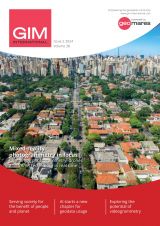
Case studies in the Philippines demonstrate the importance of timely geospatial information in natural capital accounting, which harmonizes environmental sustainability with economic exigencies. When gauging living standards, there is a...

Veronica I. Castillo is assistant professor at University of the Philippines Los Baños. She has a BSc in Economics (Natural Resource Economics) and an MSc in Economics (Environmental Economics). An...

Woolpert has acquired Murphy Geospatial, a multidisciplinary geospatial solutions company that is headquartered in Kilcullen, Ireland. Murphy Geospatial is a private, family-owned company that delivers a broad range of services...

Despite some uncertainty, there is renewed interest in drones, and remote sensing technologies are being embraced by smaller survey companies. Read these and other findings from our annual industry survey!...

The brand-new United Nations Global Geodetic Centre of Excellence (UN-GGCE) is now operational at the United Nations campus in Bonn, Germany. Nicholas Brown, head of office of the UN-GGCE, is...

The Faroese Environment Agency, responsible for national mapping activities including land mapping and hydrographic surveying, has recently joined EuroGeographics, the representative body for European national mapping, cadastral and land registration...

3D visualization is at the heart of many geospatial data applications. Progress in 3D visualization has drastically reduced barriers to entry for new products based on large datasets, thanks to...
This site uses cookies. By continuing to use this website, you agree to our Cookies Policy. Agree