Found 6879 results
Sort by

Pointorama

Are you facing challenges in managing, cleansing, editing, filtering, classifying, sharing or collaborating on your point clouds? Discover Pointorama to move your point clouds to the next level! Pointorama is more than just a point cloud platform. It is a catalyst for innovation, efficiency and collaboration. Take your point cloud projects to new heights with our cutting-edge technology....


Read more

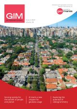
GIM - Issue 2-2024

Presenting the latest developments in aerial mapping, products and services. Intriguing real-life projects provide insights into advanced aerial photogrammetry and Lidar in practice. Moreover, this edition looks at how AI...

Read more

Faroese Environment Agency joins EuroGeographics

The Faroese Environment Agency, responsible for national mapping activities including land mapping and hydrographic surveying, has recently joined EuroGeographics, the representative body for European national mapping, cadastral and land registration...

Read more