Found 6879 results
Sort by

SimActive announces upgraded cloud capabilities

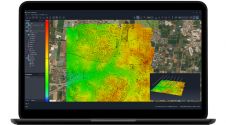
SimActive has unveiled the enhancement of Correlator3D for improved cloud environment productivity. With Correlator3D’s distributed processing capabilities, clients can seamlessly scale their processing in line with operational needs. The challenges...

Read more

Underground Mobile Mapping

Common mobile mapping systems heavily rely on positioning using GNSS. However, concrete, soil and other materials block GNSS signals, thus impeding their use when inspecting pipelines, subways or other underground...

Read more

Indoor Mobile Mapping Solution

Trimble's Indoor Mobile Mapping System (TIMMS) is a manually operated push-cart designed to accurately model interior spaces without accessing GPS. It consists of 3 core elements: Lidar and camera systems...

Read more

ZZCOMM Technology Co Ltd

Founded in 2017, ZZCOMM technology of geospatial hardware and software solutions provides rapid and high-accurate geospatial data for BIM, mining AEC, survey and mapping industries, whether they are indoor, outdoor,...

Read more

Topcon Mobile Mapping Move

Topcon Positioning Systems (TPS) Latin American distributor Geomatic Instruments Corporation (Geincor, Peru) is now offering the IP-S2 mobile mapping system. Geincor took ownership of the system in April 2011.  ...

Read more

Mobile Geological Mapping Software

GAF has released a free trial version of GeoRover, a mobile geological mapping software, developed on the basis of experience gained from real geological mapping field work. The software integrates...

Read more

Mobile Mapping System

Gispro have successfully implemented Land Based Mobile Mapping System (MMS/MLS). The system consists of Riegl laser scanners, digital videoscanners and ground-penetrating radar. Positioning and orienation are established using POS420 and...

Read more

Mapping with Mobile Lidar

The use of Mobile Lidar systems enters the scene when large areas have to be surveyed at accuracy and resolution exceeding those available through aerial photogrammetry, and when using static...

Read more