No Management without Measurement
GIS specialists in Africa are quickly seeing the horizon with respect to Geospatial Data Infrastructure (GDI); it is the bottom line that is proving elusive. Financial, budgeting and accounting measures...
GIS specialists in Africa are quickly seeing the horizon with respect to Geospatial Data Infrastructure (GDI); it is the bottom line that is proving elusive. Financial, budgeting and accounting measures...
The 12th Brazilian Remote Sensing Symposium (SBSR) was held in the Convention Center, Goiânia, Goiás State Capital from 17th to 21st April 2005. This was the biggest symposium since the...
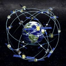
Receiver position is calculated from the position of satellites and the distances to them. Distance is calculated from the time a radio signal travels between satellite and receiver. But how...
There is general agreement that spatial data is key to sustainable resource management and overall economic development. A Spatial Data Infrastructure (SDI) in turn provides the underlying foundation for accessing...
Optech Incorporated focuses on the development, manufacture and support of advanced, lidar-based survey solutions. Established in 1974 as a privately held, Canadian-owned research and development firm, Optech was originally an...
GAF AG started out in October 1985 as privately owned company that offered services in satellite remote sensing and image processing. Over time, this core competence has developed and expanded...
This article presents a first overview of the legal issues involved in geospatial data-gathering in space. Matters of security and privacy must be resolved within a legal framework if satellite...
The Open Geospatial Consortium Inc. (OGC) (MA, USA) has established a Risk and Crisis Management Working Group (RCM WG) to address the global need for better sharing of geospatial information...
PCI Geomatics' Geomatica software and training services are helping the Multinational Andean Project: Geoscience for Andean Communities (MAP:GAC) with disaster planning and prediction. The MAP:GAC project was established to provide...
BRGM - French Geological Survey has announced the IGOS Geohazards Workshop which takes place at the BRGM Scientific and technical Centre from 27th-29th June 2005 in Orléans, France. This event...
This site uses cookies. By continuing to use this website, you agree to our Cookies Policy. Agree