Stonex unveils hybrid mobile real-time mapping solution
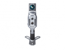
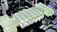
Stonex has launched a new SLAM solution for fast and efficient large-area surveys: the X70GO SLAM laser scanner. It combines mobile scanning with a stationary mode to scan with higher...
Stonex has launched a new SLAM solution for fast and efficient large-area surveys: the X70GO SLAM laser scanner. It combines mobile scanning with a stationary mode to scan with higher...
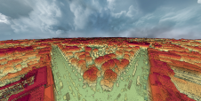
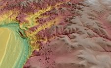
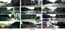
A dense annotated ground-truth Lidar dataset of the city of Dublin is the first of its kind regarding the accuracy, density and diversity of classes. The hierarchical labels offer excellent...

Global reference systems such as the International Terrestrial Reference Frame provide the foundation for determining positions on Earth and in space, as well as for reliably quantifying our planet’s changes...

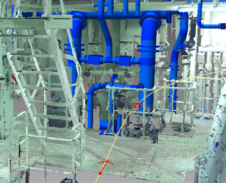
Lidaretto is flexible and compact Lidar scanning system developed since 2015 and uniquely designed to be used the way that fits best to users’ specific application. You can easily mount...
Virtual Surveyor has enhanced the Lidar elevation data handling capabilities in version 6.4 of its drone surveying and mapping software. The function enables users to select specific feature classes from...
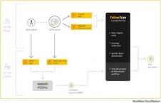
YellowScan, the UAV Lidar Solutions provider, has announced the release of CloudStation, its new software providing a complete solution to create and manipulate point cloud data. It allows the user...
Vercator Desktop software is developed by Correvate, a UCL spin-out company whose vision is to improve geospatial understanding by delivering unrivalled 3D point cloud data processing. The new software delivers...
In a paper released on arXiv, Apple engineers Yin Zhou and Oncel Tuzel have detailed an end-to-end deep neural network solution for accurate feature recognition in point clouds. One way we...
Arithmetica, the company behind Pointfuse point cloud conversion software, has announced it will be releasing Pointfuse V3 on 18 September 2017. Offering a new approach to the processing of point...
Elysium, an emerging Japan-based provider in the point cloud data industry, has released a new version of InfiPoints. Version 2.0 highlights enhancements such as pipe modelling and video generation from...
This site uses cookies. By continuing to use this website, you agree to our Cookies Policy. Agree