Found 4853 results
Sort by

Using AI for good

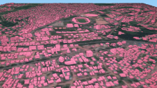
Humanitarian organizations turned to artificial intelligence (AI) to generate a comprehensive map of sub-Saharan Africa at scale and also keep it updated to reflect real-world changes. Geospatial analysis is a...

Read more

From paper to pixels in Benin

To provide all Beninese citizens the right to access land, bring economic prosperity and prevent land-related disputes, the Beninese government aims to establish a nationwide digital land administration system. With...

Read more

Filip Biljecki

Filip Biljecki is an assistant professor at the National University of Singapore and the principal investigator of the NUS Urban Analytics Lab. He holds MSc and PhD degrees in 3D...

Read more

Eric Andelin

CP, GISP, is a senior workflow specialist at SimActive Inc. He brings 40 years of experience to the mapping profession, with his geospatial background including survey, aerial photography, photogrammetry, GIS...

Read more