Accurate footprints from Antarctica
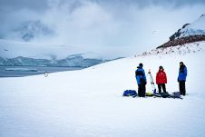
Remote sensing surveys in Antarctica based on unmanned aerial vehicles (UAVs or ‘drones’) have become a very important approach for a wide range of studies. Mapping free-from-ice-and-snow terrain and monitoring...
Remote sensing surveys in Antarctica based on unmanned aerial vehicles (UAVs or ‘drones’) have become a very important approach for a wide range of studies. Mapping free-from-ice-and-snow terrain and monitoring...

The National Land Survey of Finland (NLS) is a good example of how artificial intelligence (AI) is entering national mapping agencies. Approximately two years ago, NLS set up the Advanced...
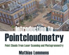
‘Introduction to Pointcloudmetry’ is the title of the new book by Mathias Lemmens, former editor-in-chief of GIM International. Despite the in-depth text, it is a clearly and accessibly presented book...
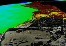
A project in Aotearoa/New Zealand is combining the use of high-quality DEMs from satellite photogrammetric mapping (SPM) with Lidar technologies to model hazards such as snow avalanches. The resulting topographic...

It is important to keep a watchful eye on glacial melt to avoid the sudden collapse of glaciers leading to tragedy, such as happened at the Marmolada glacier in the...
“Think big for coastal mapping” is the foremost advice that Don Ventura of Teledyne Geospatial would impress upon agencies interested in bathymetric Lidar. “It’s a matter of efficiency of scale.”...
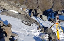
Capturing and measuring the environment in the Arctic and Antarctic is a particularly challenging job. The area of interest is often covered by a thick blanket of snow and ice,...

Airbus has released an online interface that allows customers to directly task the radar satellites and access the comprehensive 15-year radar archive. In late June, users will also be able...

The aerial survey system for upgrading digital maps of Qatar has become operational. Under the aerial surveys project for Qatar, the mission of aerial photography covering all parts of the...

The Digital Twin Victoria (DTV) Program is investing over AU$4 million in new Lidar surveys across the Australian state of Victoria to support a range of land and infrastructure management...
This site uses cookies. By continuing to use this website, you agree to our Cookies Policy. Agree