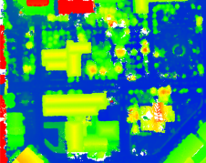
Building a 3D world: common sources of elevation data
As the demand for elevation data continues to rise, it is important that users match the level of reliability, accuracy and resolution of the data to their specific application to...

As the demand for elevation data continues to rise, it is important that users match the level of reliability, accuracy and resolution of the data to their specific application to...
DJI recently introduced the P4 multispectral, a high-precision unmanned aerial vehicle (UAV or ‘drone’) which exploits the integration of multispectral cameras to facilitate agricultural and environmental monitoring applications. Therefore, imagery...

The accuracy of coastline data in Indonesia could be much improved by making use of Lidar bathymetry technology. In this article, the authors describe how Lidar bathymetry survey techniques were...

With the rapid development of civil construction and the increasing demand for electricity in recent years, the market segment of power grid construction has grown significantly. Meanwhile, how to efficiently...

Lidar technology is synonymous with 3D point clouds. To get the most out of 3D point cloud data, it is necessary to step back and continually consider the newest trends...

Remote sensing projects often begin with the question: 'Should I use aerial imagery or satellite imagery?'. During long-term projects, this question may arise again, particularly when unforeseen circumstances change the...
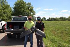
Ohio-based energy provider Dayton Power & Light is employing a fleet of senseFly eBee X fixed-wing drones to improve its large-scale data collection and mapping capacity in partnership with Sinclair...

UP42 has announced that image data and information from the planned LatConnect 60 constellation of mid-inclined orbit remote sensing satellites will be available on the UP42 developer platform for Earth...
This webinar will present the following: - Importing LiDAR point clouds - Registering LiDAR data and images automatically - Orthorectifying on LiDAR DEMs - Colorizing LiDAR point clouds

Read this farewell interview with Mathias Lemmens, who is stepping down from GIM International after 23 years as senior editor and industry figurehead. After 23 years, senior editor and industry figurehead...
This site uses cookies. By continuing to use this website, you agree to our Cookies Policy. Agree