Significant leap forward for UAV-Lidar mapping
DJI selected Intergeo in Berlin as the stage for unveiling the DJI Zenmuse L2. This highly integrated Lidar system builds on the success of DJI’s Zenmuse L1 to bring new...
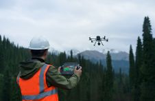
DJI selected Intergeo in Berlin as the stage for unveiling the DJI Zenmuse L2. This highly integrated Lidar system builds on the success of DJI’s Zenmuse L1 to bring new...
Vicki Speed is a freelance writer specializing in the engineering and construction space.
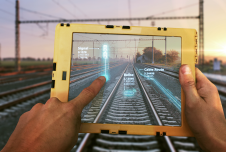
To maintain reliability and safety for passengers and freight, many of Europe’s rail networks are undergoing a massive digital modernization programme that includes digital twins. Backed by artificial intelligence (AI),...

The curtains have fallen on Intergeo 2023. What were the key takeaways from the vibrant three-day event in Berlin? From 10-12 October, a diverse array of experts and enthusiasts from...

Roshni Sharma has traversed environmental science and management, human geography, palaeoclimatology and business. She is now making it her life’s work to harness location intelligence to create tangible positive change...
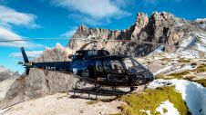
Gravitational acceleration measurements were conducted in the Allgäu region of southern Germany by the Federal Agency for Cartography and Geodesy (BKG) in September this year. In high-altitude locations, helicopters were...
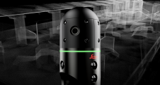
Leica Geosystems, part of Hexagon, has officially announced the Leica BLK2GO PULSE. This innovative first-person laser scanner merges state-of-the-art Lidar sensor technology with the iconic Leica BLK2GO design, representing a...
On 24 January 2023, the European Union declared the Galileo High Accuracy Service (HAS) operational for testing, and it is scheduled to become fully operational in 2024. This free signal adds...

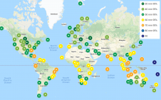
Commercial UAV Expo, presented by Commercial UAV News, is the leading international trade show and conference focusing on the integration and operation of commercial UAS in select vertical markets. 206...
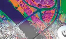
A pioneering project in Poland has proved that aerial mapping, combined with Lidar technology, can be an invaluable tool for accurately mapping the green urban environment. In fact, the new,...
This site uses cookies. By continuing to use this website, you agree to our Cookies Policy. Agree