GOES-12 Begins Coverage of South America
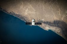
A newly repositioned NOAA satellite is broadening the coverage of the Western Hemisphere, especially over South America. This coverage will supply forecasters in South America with more imagery and data...
A newly repositioned NOAA satellite is broadening the coverage of the Western Hemisphere, especially over South America. This coverage will supply forecasters in South America with more imagery and data...
Recently, the American Association for the Advancement of Science (AAAS) released high-resolution satellite imagery to communicate the changes in South Ossetian following the clash between Georgia, South Ossetian separatists and...
EarthData International (EarthData) (MD, USA) has been awarded a US$4.3 million contract from the National Geospatial-Intelligence Agency (NGA) to map portions of one of South America’s largest countries using the...
NAVTEQ (CA, USA) has announced a full coverage map for South Africa. Included in the data set is over 450,000km of roads, enabling customers using the digital map for South...
Topcon Europe Positioning (The Netherlands) appointed Mr. Laszlo Szentpeteri as the new Regional Sales Manager for South-East Europe. Mr. Szentpeteri is born and lives in Hungary. He has over 15...
KCS BV (The Netherlands), hardware developer and manufacturer of TraceME, and ATsence BV (The Netherlands), software developer and supplier of Track and Trace solutions, have launched a tracking and tracing...
NAVTEQ (IL, USA) is offering a map with navigable coverage throughout South Korea through its wholly owned subsidiary, PMI (South Korea). The South Korea map covers 100% of the population...
NAVTEQ (IL, USA) acquired PMI, a prominent South Korean digital map company, for US$ 28.5 million. With the purchase, NAVTEQ now has a local presence in South Korea and a...

SimActive, a leading developer of photogrammetry software, has announced it has enabled the first government UAV mapping project in South Korea. Asia Aero Survey (AAS), a SimActive regional partner, used...
New knowledge and tools are needed if surveyors are to fulfil their critical role along the path to achieving humanity’s global climate goals related to land, water and the marine...
This site uses cookies. By continuing to use this website, you agree to our Cookies Policy. Agree