GPS: Position, Time and Distance
Receiver position is calculated from the position of satellites and the distances to them. Distance is calculated from the time a radio signal travels between satellite and receiver. But how...
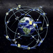
Receiver position is calculated from the position of satellites and the distances to them. Distance is calculated from the time a radio signal travels between satellite and receiver. But how...
The debate on Spatial Data Infrastructures (SDI) has reached a level of maturity that encourages reflection and facilitates evaluation of past experience. The author considers some emerging trends in the...
Founded in 1991, Jena-Optronik GmbH originates in the space department of Carl Zeiss Jena, Jenoptik and DASA (later part of today’s EADS). In 2005 Jenoptik AG took over all shares...
On January 12th 2006 came the announcement that Orbimage had acquired Space Imaging. The newly formed company, GeoEye, flies the high-resolution Ikonos, Orbview-3 satellites and Orbview-2. In 2007 it will...
On January 12th 2006 came the announcement that Orbimage had acquired Space Imaging. The newly formed company, GeoEye, flies the high-resolution Ikonos, Orbview-3 satellites and Orbview-2. In 2007 it will...
It is likely to be 2012 before the Galileo system itself is fully operational on a stand-alone basis, says this month’s interviewee Owen Goodman, and Galileo will never be a...
It is likely to be 2012 before the Galileo system itself is fully operational on a stand-alone basis, says this month’s interviewee Owen Goodman, and Galileo will never be a...
Developing countries still have a need for mapping systems that are low-cost, simple to operate by local operators, fast in production and yet meet the needs of the application. A...
Google Earth has been mentioned at least once at every meeting or conference of GIS-related professionals I’ve attended over the past year. It was even briefly referred to during defence...
The dramatic and, in some cases, damaging environmental changes sweeping planet Earth are brought into sharp focus in a new atlas launched to mark World Environment Day (WED). Produced by...
This site uses cookies. By continuing to use this website, you agree to our Cookies Policy. Agree