Spatial planning in the city of Zagreb
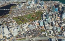
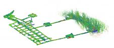
The city of Zagreb has been developing a semantic 3D city model since 2008. The city spatial planning sector was recognized as the main project user and developer, while more...
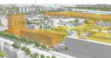
The city of Zagreb has been developing a semantic 3D city model since 2008. The city spatial planning sector was recognized as the main project user and developer, while more...
FARO has recently launched its Hybrid Reality Capture solution, powered by Flash Technology. This innovative solution offers faster scanning for large-volume projects in architecture, engineering, construction and public safety applications....
How can laser scanning and surveying firms stand out from the growing competition? This article provides tips for service providers striving to keep up with the latest technological trends while...
Russell Bollig and John Welter from Hexagon’s Geosystems division recently sat down with 'GIM International' to discuss the impact of AI on the geospatial industry. The conversation focused on hot...
Bluesky Geospatial has announced the launch of its MetroVista 3D aerial mapping programme in the USA. The service employs a hybrid imaging-Lidar airborne sensor to capture highly detailed 3D data,...
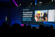
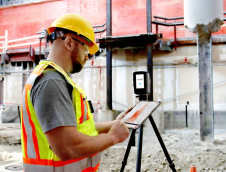
The Trimble Dimensions+ User Conference would be a good place to start for anyone aiming to reposition their business outlook or career in civil engineering, industrial technology, surveying and mapping...
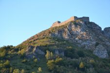
The city of Carcassonne in the south of France hopes to obtain UNESCO World Heritage certification for its sentinel mountain castles, better known as Les Châteaux Cathares. Built in the...

Sakshi Singh is a content manager at the Association of Geospatial Industries in India, where she contributes to editorial curation and design, research and documentation, marketing and outreach, and stakeholder...
The city of Kaunas, Lithuania, is leveraging a digital twin model to help with city planning. This 3D model uses data from the city infrastructure, such as traffic and weather,...
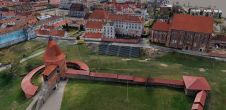
Read how SLAM technology was used to scan a former mine complex in Poland to ensure safety during a project to preserve the site's historical, educational and functional significance. Underground cultural...
This site uses cookies. By continuing to use this website, you agree to our Cookies Policy. Agree