LINZ takes New Zealand to the cloud with 20TB aerial data
Land Information New Zealand has made 20TB of aerial imagery available for free for the first time in a cloud-optimized format on Amazon Web Services (AWS), making it easier and...

Land Information New Zealand has made 20TB of aerial imagery available for free for the first time in a cloud-optimized format on Amazon Web Services (AWS), making it easier and...

Geospatial data should be integrated into the next development framework to strengthen it and make it more inclusive beyond the 2030 Agenda, says EuroGeographics. The not-for-profit membership association for European...
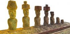
In this interview, John Ristevski, chairman and CEO of CyArk, takes us on the organization’s 20-year journey of digitally preserving cultural heritage sites. Today, the company uses advanced technologies such...
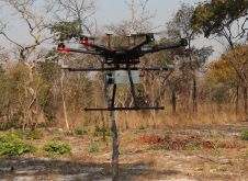
British mine-clearance charity The HALO Trust partnered with Routescene to undertake a UAV Lidar project in Cuito Cuanavale, in the Angolan province of Cuando Cubango. This case study demonstrates the...

Two expert organizations in authoritative geospatial data, cartography and GIScience have announced a new international collaboration to demonstrate the power of location. Members of EuroGeographics, the not-for-profit association for European...
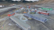
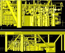
Nestled in the high Arctic Archipelago of Svalbard, the Sveagruva coal mine and mining settlement once buzzed with activity until its closure in 2016. An extraordinary project is now underway...

Driving new opportunities in the mapping landscape, a significant milestone has been achieved in New Zealand. With the introduction of 3D mapping data for the Waikato and Southland regions, access...
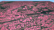
Humanitarian organizations turned to artificial intelligence (AI) to generate a comprehensive map of sub-Saharan Africa at scale and also keep it updated to reflect real-world changes. Geospatial analysis is a...
Which factors contribute to the slow adoption of TLS in Nigeria? These insights can help to stimulate the uptake of instrumentation and enhance professional surveying in other developing countries across...
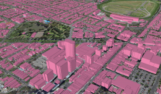
Ecopia AI and Woolpert have expanded their partnership to map Australia’s top metropolitan areas in 3D. The resulting vector maps will provide Woolpert’s Asia-Pacific clients with a detailed, accurate and...
This site uses cookies. By continuing to use this website, you agree to our Cookies Policy. Agree