JOUAV unveils advanced airborne Lidar sensor
JOUAV has released the JoLiDAR-1000 Lidar sensor designed specifically for uncrewed aerial vehicles (UAVs or ‘drones’) as the latest addition to its array of high-performance Lidar sensors for use in...
JOUAV has released the JoLiDAR-1000 Lidar sensor designed specifically for uncrewed aerial vehicles (UAVs or ‘drones’) as the latest addition to its array of high-performance Lidar sensors for use in...

A topobathymetric Lidar survey was conducted to support flood preparedness in Canada. Which techniques achieved exceptional precision, and what were the logistical challenges? Find out more in this article. As...

Visitor registration is now open for GEO Business, the UK's largest geospatial event. The free-to-attend expo, tailored for geospatial professionals seeking to harness the potential of location intelligence, will return...
Trimble has unveiled the integration of the Trimble Applanix POSPac Cloud post-processed kinematic (PPK) GNSS positioning service, featuring CenterPoint RTX, with the UAV-based mapping and data collection capabilities of DroneDeploy’s reality...
PlanetScope is now accessible on Google Cloud Marketplace. This availability of Planet's flagship satellite imaging product contributes to the company's mission to democratize access to near-daily satellite imagery, enabling organizations...

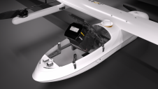
Wingtra has unveiled its innovative Lidar-drone solution. The new Lidar payload is designed to seamlessly integrate the efficiency, ease of operation, and high accuracy of the WingtraOne GEN II drones...
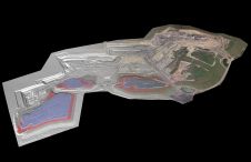
At Geo Week 2024 in Denver, Maptek unveiled its latest innovation: Maptek GeoSpatial Manager. This groundbreaking solution simplifies and streamlines workflows, revolutionizing how mining and civil engineering projects manage data...

There are indications that today’s technological advances are putting a fully operational multipurpose cadastre within reach, following decades of a global vision and small-scale progress towards a comprehensive map-centric land...
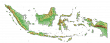
Intermap has won a US$20 million contract to map the Indonesian island of Sulawesi this year. The contract is the first phase of the Indonesian national topographic basemap programme to...
SimActive has unveiled the enhancement of Correlator3D for improved cloud environment productivity. With Correlator3D’s distributed processing capabilities, clients can seamlessly scale their processing in line with operational needs. The challenges...
This site uses cookies. By continuing to use this website, you agree to our Cookies Policy. Agree