The role of surveyors in building climate resilience
New knowledge and tools are needed if surveyors are to fulfil their critical role along the path to achieving humanity’s global climate goals related to land, water and the marine...
New knowledge and tools are needed if surveyors are to fulfil their critical role along the path to achieving humanity’s global climate goals related to land, water and the marine...
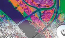
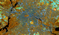
A pioneering project in Poland has proved that aerial mapping, combined with Lidar technology, can be an invaluable tool for accurately mapping the green urban environment. In fact, the new,...

From 10 to 12 October, the vibrant capital city of Germany will be the epicentre of geoinformation innovation as it hosts Intergeo Expo and Conference. With a rich array of...

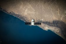
Adina Gillespie is the vice president of strategic initiatives at Hexagon Geosystems. With over 15 years of experience in Earth observation (EO) technology, she focuses on advancing technology and data...
In this exclusive interview, two of the driving forces behind this year's Intergeo talk about the event's evolution and impact, nurturing talent, land surveying, Earth observation and the Blue Economy....
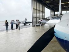
What are the challenges of image-based data acquisition for photogrammetric mapping and mesh modelling? And how can photogrammetry be made accessible? The annual Open Day Photogrammetry provided some answers to...
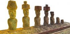
In this interview, John Ristevski, chairman and CEO of CyArk, takes us on the organization’s 20-year journey of digitally preserving cultural heritage sites. Today, the company uses advanced technologies such...

A new strategic partnership between Umbra and European Space Imaging (EUSI) will allow customers to purchase Umbra’s industry-leading synthetic aperture radar (SAR) data directly through EUSI. Umbra is a leader...

Katherine James, a remote sensing specialist at The HALO Trust, is specialized in the use of UAVs for assisting in the removal of landmines and other unexploded ordnance in countries...
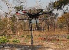
British mine-clearance charity The HALO Trust partnered with Routescene to undertake a UAV Lidar project in Cuito Cuanavale, in the Angolan province of Cuando Cubango. This case study demonstrates the...
This site uses cookies. By continuing to use this website, you agree to our Cookies Policy. Agree