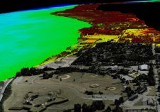
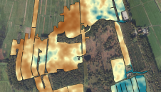
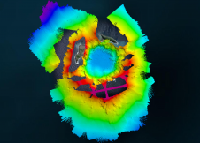
Found 46 results
Sort by

Think Big for Coastal Mapping

“Think big for coastal mapping” is the foremost advice that Don Ventura of Teledyne Geospatial would impress upon agencies interested in bathymetric Lidar. “It’s a matter of efficiency of scale.”...

Read more

Soil mapping with drones

The Earth sciences sector is rapidly adopting UAVs. These two studies have explored combining a gamma-ray spectrometer with a drone to map soil properties. In the Earth sciences sector, sensors...

Read more

Ronald Koomans

Ronald Koomans studied geology at Utrecht University and did his PhD at the nuclear physics lab of the University of Groningen on the application of an underwater gamma-ray spectrometer to...

Read more