Object-based Image Analysis
Looking at a satellite image one sees squares (i.e. pixels) representing landscape, although the actual shapes of roads, rivers, lakes, forest and nature reserve might more accurately be represented by...
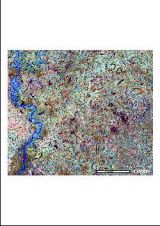
Looking at a satellite image one sees squares (i.e. pixels) representing landscape, although the actual shapes of roads, rivers, lakes, forest and nature reserve might more accurately be represented by...
Around 30 water authorities from more than 15 African countries gathered in Nairobi, Kenya, from 26 to 30 November, to attend an advanced ESA TIGER training course on utilising Earth...
In Austria many manmade objects such as roads and buildings are vulnerable to landslides caused by heavy rainstorms. These result from climate change and changes in geological structure. Using GIS,...
Although operational for more than twenty years, Airborne Lidar Bathymetry (ALB) has rarely been used in riverine areas. The US Bureau of Reclamation adopted it to study how flow change...
The ECOLAB 2004 Congress was held in Cayenne, French Guyana, from 30th November to 5th December with the objective of exchanging scientific progress on the management and conservation of Amazonian...
GAF AG (Germany) in co-operation with the Federal Institute for Geosciences and Natural Resources of Germany (BGR) has been awarded a consulting service contract by the World Bank (IDA) funded...
This site uses cookies. By continuing to use this website, you agree to our Cookies Policy. Agree